Pulp and paper supplier denies draining peat on island near Singapore
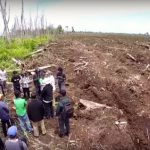
A NASA satellite detected 140 hotspots in West Kalimantan on September 12 as smallholders in the province continued to burn land for agriculture, Indonesia’s disaster management agency said on September 13. Data from Global Forest Watch shows the district of Ketapang recorded 144 fire alerts over the last seven days, 44 of which were in the subdistrict of Hulu Sungai. The number of fire alerts in Ketapang is more than double the number in Melawi, the district with second-highest number of fires. Both districts are contiguous and lie to the south of provincial capital Pontianak. Indonesian state media reported that the disaster management agency had dispatched Bell 214 and Bolco helicopters to drop water on fires while the air force was operating cloud-seeding flights in the area. A total of 3,500 personnel were working to extinguish fires. Joko “Jokowi” Widodo has pledged to significantly curtail annual wildfires before his term as president ends in 2019. The government’s ability to mitigate fires will in part depend on the success of the peatland restoration agency, known as the BRG, that Jokowi created in January by decree to rehabilitate 2 million hectares of peat.

